geos_intersection()returns the set of points common to bothxandy.geos_difference()returns the set of points fromxthat are not contained byy.geos_sym_difference()returns the set of points that are not common toxandy.geos_union()returns the set of points contained by eitherxory.geos_shared_paths()returns a GEOMETRYCOLLECTION containing two MULTILINESTRINGS: the first containing paths in the same direction, the second containing common paths in the opposite direction.geos_snap()snaps the vertices ofxwithintoleranceofytoy.geos_clearance_line_between()calculate the clearance (shortest distance) betweenxandy, result is a LINESTRING that touches each geometry.
geos_intersection(geom1, geom2)

geos_difference(geom1, geom2)

geos_sym_difference(geom1, geom2)

geos_union(geom1, geom2)

geos_intersection_prec(geom1, geom2, grid_size)

geos_difference_prec(geom1, geom2, grid_size)

geos_sym_difference_prec(geom1, geom2, grid_size)

geos_union_prec(geom1, geom2, grid_size)

geos_shared_paths(geom1, geom2)

geos_snap(geom1, geom2, tolerance = .Machine$double.eps^2)

geos_clearance_line_between(geom1, geom2, prepare = FALSE)
Arguments
- geom1, geom2
GEOS geometry vectors, recycled to a common length.
- grid_size
For
_prec()variants, the grid size such that all vertices of the resulting geometry will lie on the grid.- tolerance
The maximum separation of vertices that should be considered equal.
- prepare
Use prepared geometries to calculate clearance line
Value
A GEOS geometry vector along the recycled
length of geom1 and geom2.
Examples
poly1 <- "POLYGON ((0 0, 0 10, 10 10, 10 0, 0 0))"
poly2 <- "POLYGON ((5 5, 5 15, 15 15, 15 5, 5 5))"

geos_intersection(poly1, poly2)
#> <geos_geometry[1]>
#> [1] <POLYGON ((10 10, 10 5, 5 5, 5 10, 10 10))>
geos_difference(poly1, poly2)
#> <geos_geometry[1]>
#> [1] <POLYGON [0 0...10 10]>
geos_sym_difference(poly1, poly2)
#> <geos_geometry[1]>
#> [1] <MULTIPOLYGON [0 0...15 15]>
geos_union(poly1, poly2)
#> <geos_geometry[1]>
#> [1] <POLYGON [0 0...15 15]>

line <- "LINESTRING (11 0, 11 10)"
geos_snap(poly1, line, tolerance = 2)
#> <geos_geometry[1]>
#> [1] <POLYGON ((0 0, 0 10, 11 10, 11 0, 0 0))>

geos_shared_paths("LINESTRING (0 0, 1 1, 2 2)", "LINESTRING (3 3, 2 2, 1 1)")
#> <geos_geometry[1]>
#> [1] <GEOMETRYCOLLECTION (MULTILINESTRING EMPTY, MULTILINESTRING ((1 1, 2 2)))>

## generate a line that connects two geometries at their nearest place
## (not necessarily a vertex of either)
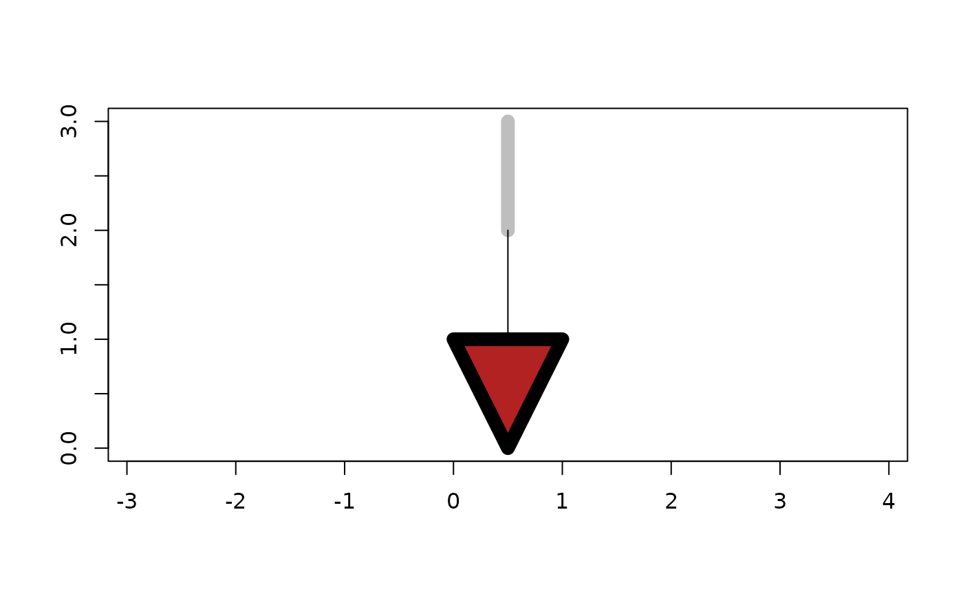
a <- as_geos_geometry("LINESTRING (0.5 2, 0.5 3)")
b <- as_geos_geometry("POLYGON ((0 1, 0.5 0, 1 1, 0 1))")
plot(c(a, b), col = c("grey", "firebrick"), lwd = 10)
plot(geos_clearance_line_between(a, b), add = TRUE)
